It’s a little hard to believe, but the concept of recording land ownership in a centralized (and supervised) public location is a relatively new thing. In Great Britain, a nationwide mandate was not enacted until 1990. The title work! The property claims! It must have been a messy process. And what if a deed went up in a fire or was thought to have turned to ash?
Here’s a Chat overview of the history of real property titling.
1. The Era of Deeds and Legal Descriptions (Pre-19th Century – Early 20th Century)
- Great Britain
- Land ownership was historically recorded through deeds, private legal documents that had to be manually traced to prove ownership.
- The system lacked a central registry, meaning land transactions relied on historic title chains stored by property owners and lawyers.
- United States
- A similar system of deed recording existed, often based on metes and bounds descriptions (especially in the Eastern U.S.) or the Public Land Survey System (PLSS) (for lands acquired after 1785).
- County governments recorded deeds, but there was no standardized way to track land ownership.
2. Early Land Registries and First Steps Toward Systematic Record-Keeping (Mid-19th Century – Early 20th Century)
- Great Britain
- 1862 – Land Registry Act established HM Land Registry, but participation was voluntary.
- 1875 – Land Transfer Act simplified the process, but land registration was still not compulsory.
- 1897 – London mandated land registration, gradually expanding nationwide.
- United States
- 1800s – Early county plat maps and tax assessment rolls began organizing land records more systematically.
- Late 19th – Early 20th Century – Cadastral surveys (especially in the Western U.S.) improved property mapping.
- 1920s-1930s – States and local governments began experimenting with numbered parcel systems for property taxation.
3. Systematic Land Registration and Adoption of Parcel Numbering (Mid-20th Century – 21st Century)
- Great Britain
- 1925 – Land Registration Act made registration compulsory for land sales in designated areas, gradually covering more of England and Wales.
- 1990 – Almost all land transactions required registration.
- 2002 – Digital land registration introduced, enabling electronic transactions.
- United States
- 1950s-1970s – Parcel Identification Numbers (PINs) were introduced in many counties to systematically track land ownership and taxation.
- 1970s-1990s – Geographic Information Systems (GIS) were integrated into land records, linking parcel data to maps.
- 2000s-Present – Digital land records became the norm, allowing online access to property information.
Key Takeaways
- Both Great Britain and the U.S. started with deed-based systems requiring lengthy title searches.
- Great Britain centralized land registration earlier (1862), but it became widespread only by the 20th century.
- The U.S. never adopted a national land registry but instead developed county-based parcel identification systems (PINs) during the mid-to-late 20th century.
- Both systems are now largely digital, enabling online property searches, tax assessments, and real estate transactions.
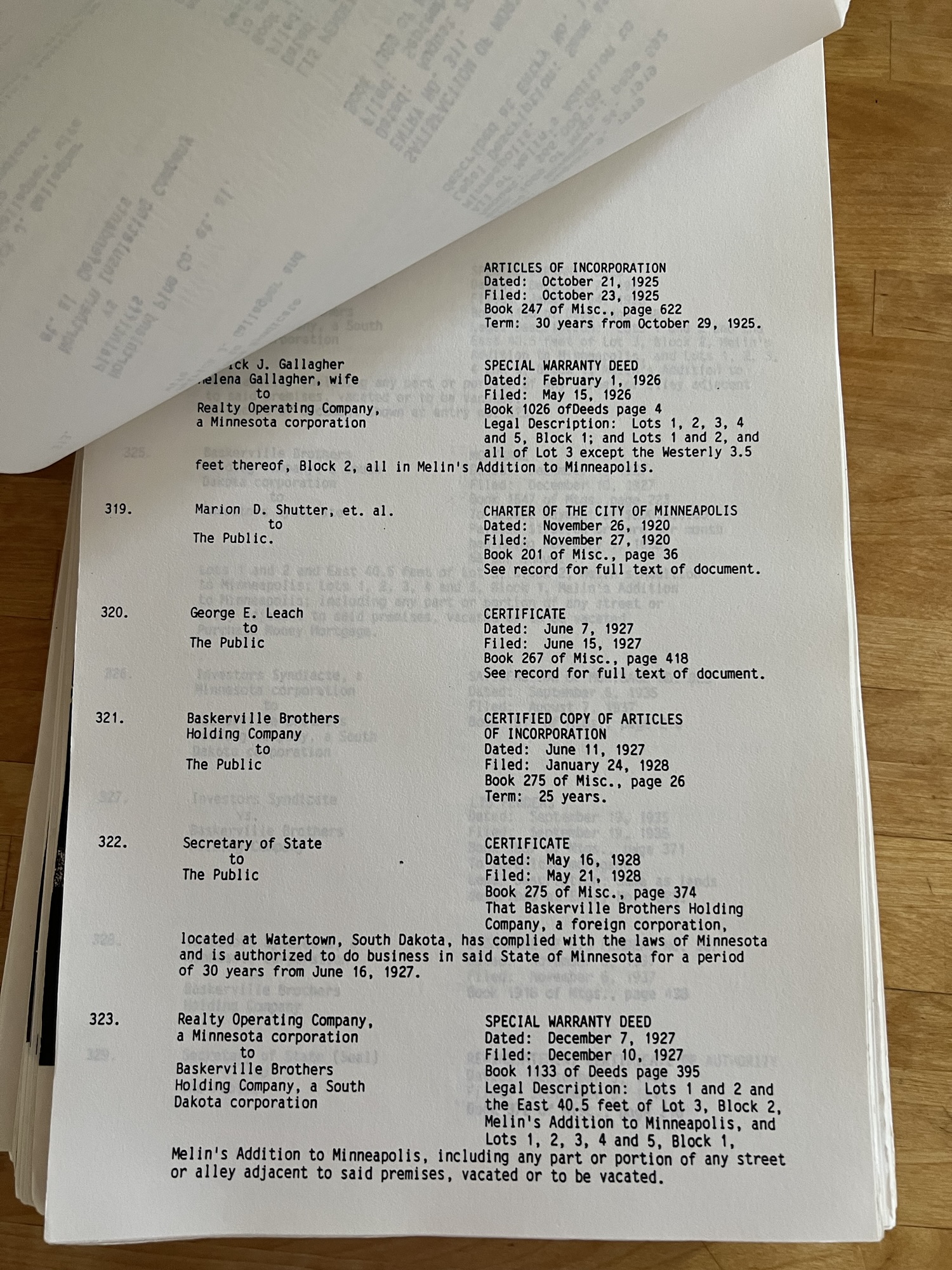
It was only twenty-five years ago that abstract books were still in circulation. When a property changed hands, the abstracts were located and pages were added to reflect the changes. The result multi-page pad told the parcel’s ownership story, as seen below.