If you are looking for micro level data on a particular neighborhood, you’ll be happy to know that it is available curtesy of the United States Postal Service.
As a service to businesses who would like to mail marketing pieces to homes, the Every Door Direct Mail program allows you to search by mail carrier route to get a feel for neighborhood composition and level of income.
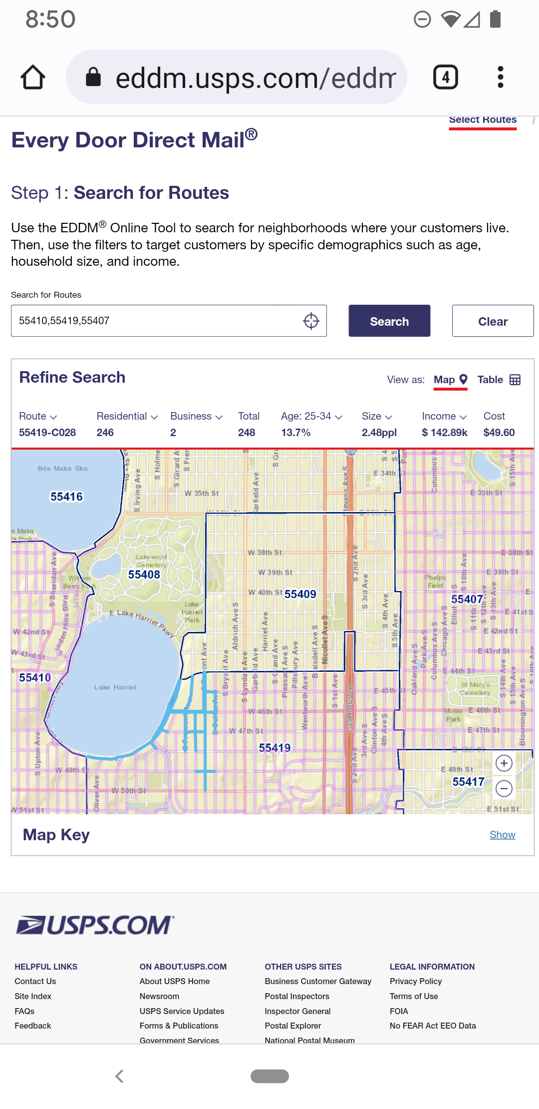
In this first screen shot the light blue line delineates a collection of 246 residents on Lake Harriet, one of the lakes in the Minneapolis Chain of Lakes. The average income of the occupants is reported at $142.89K (if you are from a coastal region this may sound average, but it is high after cost-of-living adjustments).
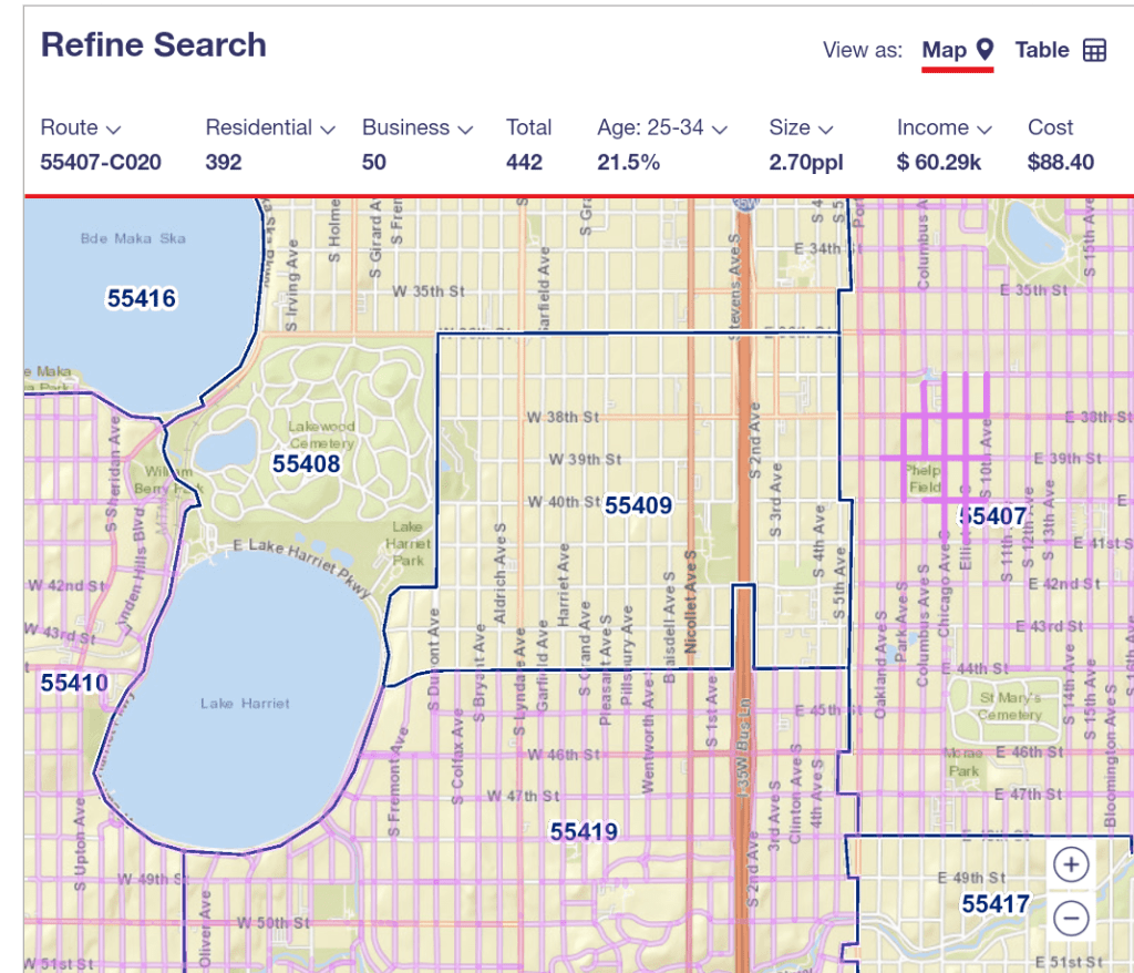
A couple of miles away, another mail carrier route shows a different density and income level. With 392 residents contained in a similar surface area, we can imagine smaller lot sizes. The adjusted income indicates more modest housing.
When working with big data sets, the details are often averaged out. A tool such as this one allows you to test the numbers and see if they are consistent across a larger area.
Or you can just use it to check on your neighbors!
